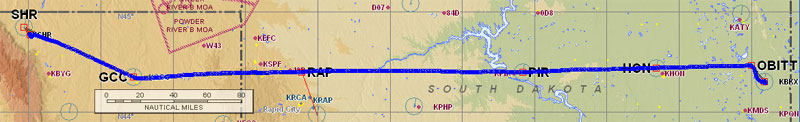
Day 1: Nampa, ID to Minneapolis, MN
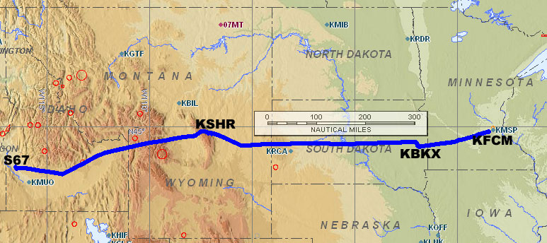
A journey of several thousand nautical miles begins with the first take off. Our wheels left the familiar patch of runway of our home base at Nampa, Idaho (S67) at 7:00 am MDT as we headed east towards our first refueling stop: Sheridan, Wyoming (KSHR). After that, the plan was to make another fuel stop in Brookings, South Dakota (KBKX) before reaching our overnight stop at the Flying Cloud Airport (KFCM) in Minneapolis, Minnesota. If all went according to plan, we’d be landing at Flying Cloud about 8 hours after our first take off, which would be around 4:00 pm CDT. As you’ll soon find out, not everything went according to plan and for a while there, we didn’t think we’d even make it beyond Wyoming.
Flight 1: Nampa, ID to Sheridan, WY
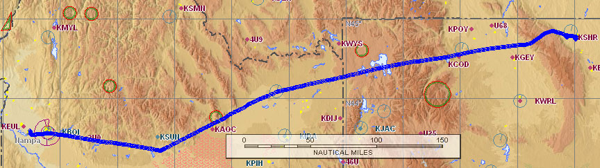
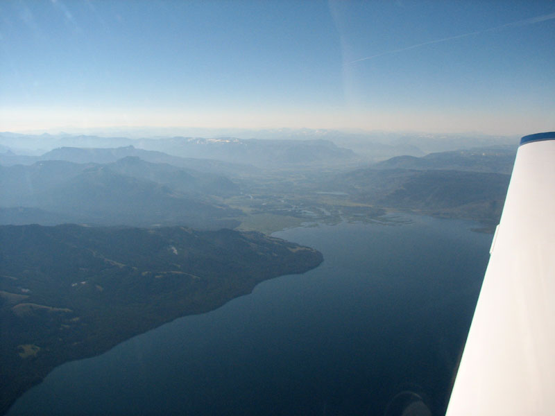
Our track for Flight 1 from Nampa, ID to Sheridan, WY. You can see all the high terrain along the route which required us to climb to 13,500 feet.
Shortly after departing Nampa, I made a slight turn to the south to stay out of the Boise Class C airspace while I called Flight Service on the radio to open our VFR flight plan. After doing that, I contacted Boise Approach and requested flight following to Sheridan. Boise handed us off to Salt Lake Center who watched us on radar for the rest of the way to our first stop. Once we were on track, I plugged the iPod into the intercom and appropriately chose the song “Fly” by Sugar Ray as our first selection on our mini jukebox.
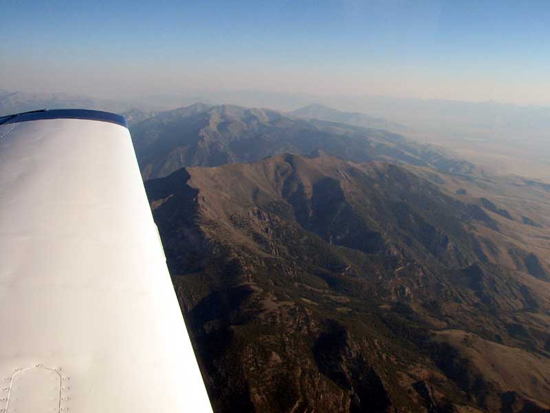
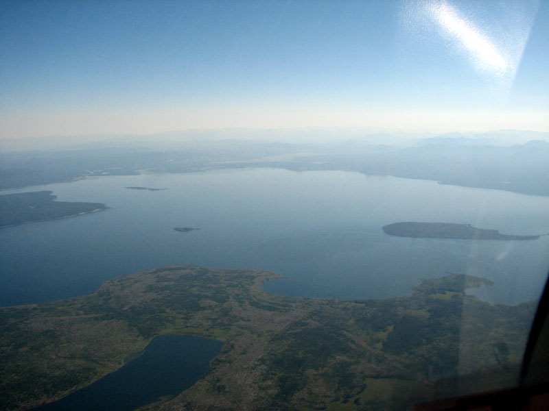
We had to climb to 13,500 feet to clear the mountains along the Idaho-Wyoming border. Most of our legs on this trip will be IFR, but we chose VFR for this leg due to the mountains. In order to make this trip under IFR we’d have to climb to over 15,000 feet. We can fly at that altitude, but it takes a while to climb that high and our non-turbocharged engine doesn’t produce as much power up that high. Clouds were not an issue for this flight, so staying VFR was not a problem. We enjoyed tremendous views of the desert, mountains, lakes and rivers on the way. We even flew right past Yellowstone National Park, and got a great look at Yellowstone Lake. The air was smooth and we snapped away with the camera, even though we knew the pictures never look as good as the real thing.
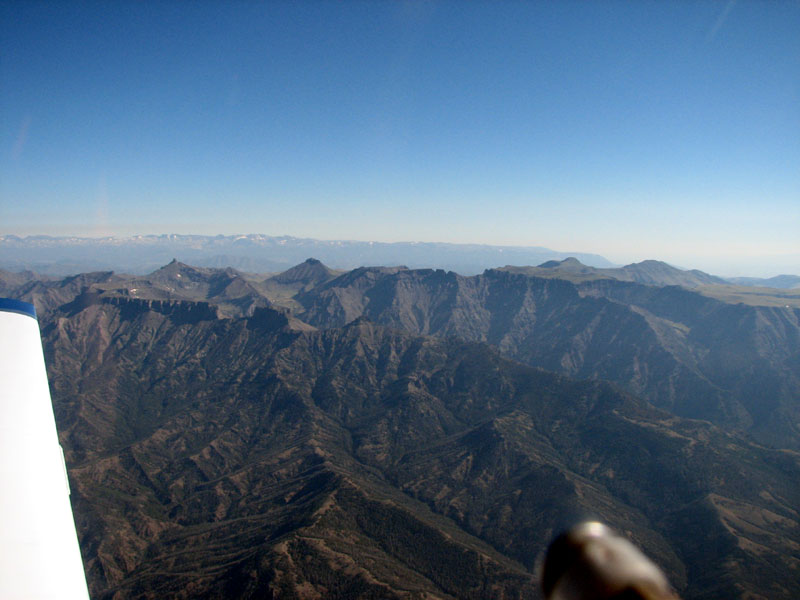
The flight was extremely smooth with little wind and no turbulence. There’s a 10,000 foot mountain range we had to clear before descending to 4,000 feet to land in Sheridan. After clearing the 10,000 foot peaks, I made a series of descending turns to help us lose altitude before we got to the airport area. We were soon on the ground in Sheridan for a quick fill up before continuing eastbound. The crew from Bighorn Aviation quickly helped us park, took our fuel order and volunteered to clean the windscreen. I told them we were planning to make a quick check of the weather and we planned to be off again within 30 minutes (but things didn’t go according to plan, as you’ll soon find out). Phil and I stepped inside the cool air of the FBO for a quick weather update. I found a cold lemonade while Phil called Flight Service.
I phoned in to file our IFR flight plan to Brookings, SD and get an updated weather briefing. While I was doing this, I also used the computer at Bighorn Aviation’s flight planning room to check out the weather radar picture for our route to Brookings, and eventually to Minneapolis. The briefer I got was extremely friendly and personable, which is always nice. Sometimes you get briefers who barely do more than read you the text they are seeing on their computer screens. This briefer gave me a good summary of the weather ahead — it was clear all the way to Brookings with some scattered clouds forecast as we got closer to Minneapolis.
Clear skies confirmed, we settled our bill with Bighorn Aviation and discovered a discount for Saturday fuel purchases. Nice! We eagerly climbed in the Mooney excited to launch towards Brookings, SD. Unfortunately, the Mooney wasn’t ready to leave Sheridan. Phil cranked the starter, but the prop wasn’t spinning. The starter was turning but the gear that is supposed to engage with the propeller wasn’t doing its thing. All we heard was a whirring sound as the starter motor turned without driving anything. We heard this exact same sound in Sunriver, Oregon last summer. The cause of that problem turned out to be a weak battery. During the Sunriver trip, we were able to start successfully after pulling the prop through several rotations by hand which gave the battery a little boost by spinning the alternator. Unfortunately, that trick didn’t work this time and we knew we needed to ask for help.
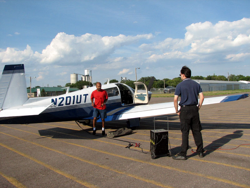
Suspecting a weak battery might be the problem again, we thought a charge might help initiate the starter. We borrowed an external charger from Bighorn Aviation, and waited 15 minutes. Still not start. Luckily, a mechanic was on duty this sunny Saturday afternoon. A lineman hooked up the Mooney to a tow vehicle to bring it to the maintenance hangar. There was only one spare seat on the tow vehicle, so Phil went with the Mooney while I thoughtlessly returned to the air-conditioned FBO. I immediately regretted the decision to separate myself from Phil and the plane once I realized we didn’t have cell phone coverage in Sheridan. Another lineman offered to shuttle me over to the maintenance hangar, and I gladly accepted.
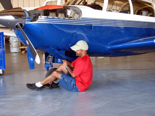
Brian, the mechanic, tried to help us right away. He was very patient while Phil, the protective airplane owner, followed him around volunteering to help wherever he could. I decided that two heads were enough and entertained myself by taking pictures and trying out the camp chairs that we brought for the Oshkosh air show.
Brian was working on another airplane, but he quickly finished what he was doing and took a look at our Mooney. He did a quick test of our battery and its cells and found them to be ok. That was good, since the battery was replaced just 11 months ago. Brian also checked and cleaned the electrical connections to the starter, and lubricated the gear that wasn’t engaging to turn the propeller.
Brian gave us the thumbs up, and sure enough, the Mooney started right up. In order to pay our maintenance bill (a very reasonable $65 for an hour of labor), we had to taxi over to the main terminal building. After settling up the tab, we crossed our fingers and the Mooney started up again with no problems and we were on our way to the next stop: Brookings, SD. With two good starts under our belts, we figured out starter problems were solved and, with any luck, this would be our last maintenance issue of the whole trip.
Our original plan was to be in Sheridan for just 30 minutes, but our total time on the ground ended up being just over 3 hours. We landed there at 10:00 am, and departed at 1:15 pm. We were well behind schedule, but at least we were on our way.
Flight 2: Sheridan, WY to Brookings, SD
Sheridan is a non-towered airport, so we just self-announced our intentions on the designated frequency and headed on course to the east. Now that we were clear of the Rocky Mountains the highest terrain on our route to Brookings was at 6,500 feet along the Black Hills of South Dakota. The rest of our legs for this trip would be done IFR, and our filed cruising altitude for this leg was 9,000 feet. We radioed Salt Lake Center after departing Sheridan to pick up our IFR clearance. This is an area of marginal ATC radar coverage, so the controller instructed us to report reaching 9,000 feet and also to report when 30 nautical miles northwest of the Gillette VOR. If we were in an area of good radar coverage, neither of those reports would have been needed.
We climbed to 11,000 to stay above the cloud tops and the Black Hills were soon in sight. Sturgis, South Dakota was located just north of our route. When we would tell our non-pilot friends and family about our upcoming plans to attend AirVenture, most had a hard time understanding our excitement until we equated it to the annual Sturgis Motorcycle Rally. South of Sturgis was the Mount Rushmore memorial. When we started planning this trip several months ago, we had talked about a possible stop to see Mount Rushmore. Sadly, it was too late to make a detour. The clouds began to thicken and we requested a block from 11,000′ to 13,000′ shortly after switching to the Minneapolis Center frequency. Getting a block altitude and staying above the tops is a good way to avoid flying into bad weather. By doing this, we can see where the clouds are building up (and more importantly where it’s clear).
ATC notified us of traffic to the northwest of our current position which was running parallel to our course and overtaking us at an altitude just 1,000′ below ours. We were in and out of the clouds, but could see the traffic approximately 2 miles north. We both found it strange that the other plane wasn’t talking with ATC since he was also in and out of the clouds. For VFR flights, communication with ATC isn’t required but you do need to remain 1,000 above and 1,000 feet below the clouds and maintain 5 miles visibility. From our perspective, he wasn’t legal. We let ATC know and they kept a closer eye on us until we got nearer to Brookings.
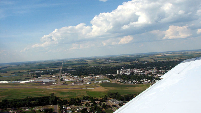
The elevation change was more obvious as we descended towards Brookings. We were no longer in the desert or mountains. A lush blanket of green below was dotted with too many lakes to count. The airport was quiet for a Saturday evening as we made a smooth landing and taxied to the fuel pump. The lineman used his John Deere tractor to guide us there. He filled the tanks while we went inside for a weather update.
The weather to Flying Cloud was mostly clear with one storm cell just north of our route. We’d keep an eye on it during the flight and make the necessary adjustments to our course. We settled our bill and climbed back into the Mooney grateful for the quick fuel stop versus our long stay in Sheridan.
Unfortunately, we had the same starting issue. The starter just whirred, but the prop did not move just as we experienced in Sheridan. We’d learned a lot in Sheridan, so we had a good idea of how to get it going again. Big Sioux Aviation also had an external charger for us to borrow. We rolled it out and plugged in the Mooney once again. Phil confirmed that the battery was charging, and then tried to start. No luck, so we decided to wait. After 20 minutes the voltage registered higher and we tried starting with the charger still plugged in. First try, no start. Second try, the prop did spin, but not enough for a start. We were so close, could it really work? The third try was definitely the charm. The Mooney started and we were all thrilled. I unplugged the charger, collected the jumper cables and joined Phil inside the cabin for our next leg.
I contacted the Huron Flight Service Station on 122.65 to get our IFR clearance to flying cloud. The FSS specialist had to telephone the air traffic controller working this area to get our clearance, and then he relayed the clearance to us, “ATC Clears N201UT to the Flying Cloud airport via Redwood Falls then as filed. Climb and maintain 7,000. Departure frequency 132.05, squawk 4566. Clearance void if not off by 0007, time now 2358.” In case you are wondering, 0007 and 2358 times given in GMT. Greenwich Mean Time is the one time zone all pilots use across the world, since it’s so common to be working across time zones. It’s easy to get confused converting between local time and GMT, which is why the FSS specialist gave me the current GMT time just as a double-check. The local time was 6:58 pm (or 1858 if you want to sound cool) CDT (Central Daylight Time).
The Big Sioux Aviation lineman’s help made all the difference. He was running a solo show this evening and his shift was scheduled to end within the hour. He volunteered to stay late and help us track down a mechanic if we needed one. Once we were airborne, the lineman radioed to say “Have a safe flight.” We radioed back thanking him for his help (and we also left him a good tip before we departed too).
Flight 3: Brookings, SD to Flying Cloud, MN
I was very relieved to be in the air again. Our view was of blue sky with a storm in the distance (well north of our route). I realized that I had left the camera in the rear baggage area which was out of my reach. Determined to document each leg of our trip, I unbuckled and climbed back to retrieve it. I was sure the camera case was resting on top, but couldn’t feel it. The Mooney cargo space always seemed small, but now it felt bottomless while I searched for the camera. I started to worry that I left it behind in the Brookings FBO. How could we possibly go to AirVenture without our camera? I didn’t want to stay unbuckled for long, so I headed back to the front and broke the news to Phil. He wasn’t worried at all. He knew we’d find it when we landed. (He was right. The camera had settled to the bottom of the baggage compartment, well out of my reach.)
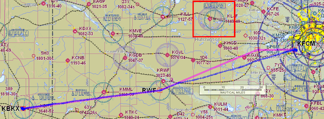
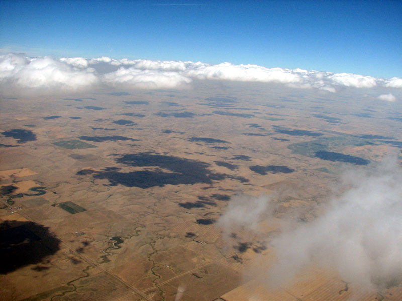
We’ve owned our Garmin GPSMAP 396 for about a year now. One of the big selling points of it is the ability to get in-flight weather updates right on the GPS display. During most of our trips over the past year, the weather was pretty good so we didn’t get to take full advantage of the capabilities of the 396. On this trip, the GPS proved invaluable. We were able to get fresh updates from weather radar every few minutes and see that the thunderstorms we heard about north of our route were still there and moving south. However the storms appeared to be halting their progress right around the Darwin VOR (see the map on the right).
We watched the storm cell at Darwin closely during this leg. We did deviate 15 degrees south of our planned route to avoid a buildup. The deviation south kept us even further from the storm at Darwin, and the controller cleared us direct to Flying Cloud once we were done making our deviation. Other than that, there were no weather issues at all and soon the tall buildings of downtown Minneapolis popped out of the horizon.
Soon after spotting downtown Minneapolis, we found the Flying Cloud airport and were cleared for the visual approach, and then cleared for landing on runway 28L. While we were on the base leg for 28L, the controller cleared a business jet to take off on the same runway. In order to have more of a buffer to avoid the wake turbulence from the jet, I asked to switch to runway 28R and that was approved. After all the problems we had this day, it was a relief to finally land at Flying Cloud. We arrived at 8:00 pm CDT (Central Daylight Time), which was 4 hours behind schedule.
After shutting down at Flying Cloud, we were curious if the Mooney would start up again or need more help. Our suspicion was confirmed when, once again, the starter would spin but not the prop. We would definitely need a mechanic’s help before continuing.
The Flying Cloud airport is wide open with a view that extends miles in all directions on a clear day. The line team took advantage of this view and felt obligated to judge the incoming landings on a fairly slow Saturday evening. The lineman told Phil that he won the “best landing of the day award.” I think Phil might have blushed, but I was glad that someone besides me recognized his talent. It’s always good to have witnesses when you manage to make a good landing.
Elliott Aviation was expecting us and had a crew car waiting on the ramp for our overnight use at no charge. They had previously coordinated our hotel reservation at their discounted rate. The Elliott team had everything ready to go, including directions and dinner recommendations.
We ended up stopping at 3 of the 4 Elliott Aviation locations in the Midwest during this trip. Each one was well run, and had a great staff that treated us just as nicely as they treated the folks coming out of the multi-million dollar jets.
A Change of Plans
The original plan was to spend the night in Minneapolis and to fly to Appleton, Wisconsin the next day (Sunday, July 23rd). However given all the starter problems we had during this day’s flights, it just didn’t make sense to attempt to fly to Appleton. Getting timely maintenance help in Appleton would be difficult because of all the other pilots who would be in the area at the same time. We concluded that our best bet was to get the airplane looked at in Flying Cloud.
When we landed at Flying Cloud I told the folks at Elliott Aviation that we’d need a mechanic to take a look at our starter problems. They’ve got their own maintenance shop, but they actually recommended we contact ASI Jet Center who is also at the Flying Cloud airport, and is a Mooney Service Center. Neither Elliott nor ASI had mechanics on duty over the weekend, although we could call one in for “emergency service” at a hefty price premium. That didn’t seem like the right thing to do, so we elected not to go that route. We’d think through our options and make a decision of what to do the next day.
During the short drive to the hotel we figured out a good alternative plan. We’d rent a car from Elliott Aviation the next morning and just drive ourselves to Oshkosh. The drive shouldn’t take too long — since the flight time was about 1.5 hours I guessed that driving would be around 5 hours. We could contact ASI Jet Center the next morning (Sunday, July 23rd) and see if they could take a look at our starter problems. If we were lucky, they’d be able to squeeze us in and finish up with the Mooney by the morning of Wednesday, July 26th when we were planning to fly to Manassas, Virginia for the Washington, DC portion of our trip. I liked this option because it allowed us to stay on schedule, relax and enjoy the show. In addition, the mechanics wouldn’t feel rushed to get us flying again. After all, we still had a ways to go.
Over dinner we reflected on how the trip was going thus far. Sure, we didn’t count on having mechanical problems, but we made it to our first planned overnight stop. We had a good plan to see the AirVenture show, and hopefully get the Mooney fixed up while we were away in Oshkosh. We both agreed that we were enjoying our adventure so far, and looking forward to whatever was next.